
Shadow Vet Drone Ops / Thermal Recovery
WHEN THE TRAIL GOES COLD, LOOK ABOVE.
Thermal drone search inquiries for qualified wounded-deer recovery, missing pets and livestock. Veteran-operated, Mississippi-based mission support with an emphasis on practical planning and responsible operations.
Deer-recovery requests are screened for lawful activity, landowner permission and mission readiness. A call is not a confirmed dispatch.
Thermal Search Services
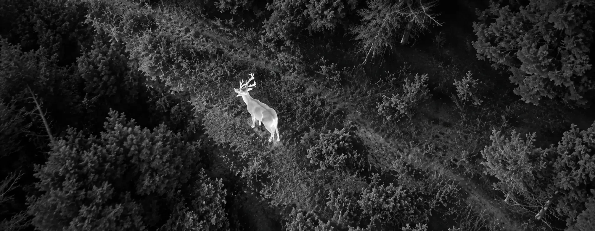
A different view when visibility is limited.
Thermal cameras can highlight temperature differences, making some animals easier to observe through openings in cover or across open ground. Dense canopy, terrain and environmental conditions can still prevent detection.
Wounded-Deer Recovery Inquiries
Requests involving lawfully wounded deer are evaluated case by case. SVDO does not perform active-hunt scouting, direct hunters to live deer, harass wildlife or promise recovery outcomes.
Missing Pets
Aerial search assessment for missing dogs and other pets on rural property, wooded edges and open areas where thermal conditions may support a search.
Livestock Location
Search and observation support for cattle and other livestock across pastures, timber edges and difficult-access acreage, with operator-reviewed findings.
What Happens Next
One call. A clear mission review.
Share the Location
Call or text the county, property location, last known position, approximate time and land-access permission. For missing pets, share a recent description.
We Check Feasibility
We assess legal restrictions, aircraft readiness, FAA airspace, access, terrain, weather, the mission objective and reasonable search limitations.
Scope & Coordinate
If the request is suitable and permitted, we confirm scope, scheduling, pricing and communication rules before any operator-authorized flight.
Thermal Technology / Examples
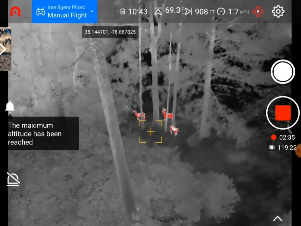
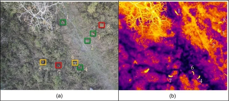
What thermal imagery can reveal.
These examples illustrate thermal image contrast and observation workflows. They are reference materials, not proof of completed SVDO recovery missions or guaranteed sensor performance.
Our Standard
Technology with accountability.
SVDO evaluates whether a drone makes sense for the situation. If lawful operation, aircraft readiness or conditions are not suitable, we will not represent the mission as cleared to fly.
Google Customer Reviews
What our customers are saying
Google reviews reflect customer experiences with Shadow Vet Drone Ops across its services; they are not guarantees of thermal search or recovery outcomes.
If the reviews do not display in your browser, view customer reviews directly.
Ready to Discuss a Search?
Tell us what happened and where.
Florence, Mississippi · Serving Central Mississippi and surrounding areas on a mission-specific basis.
Availability is subject to legal and wildlife restrictions, landowner authorization, aircraft commissioning and insurance verification, pilot authorization, access, airspace, weather and search conditions. Mississippi rules do not explicitly establish general permission for drone-assisted deer recovery. No detection or recovery is guaranteed. Illustrative thermal images must not be presented as SVDO mission results without source verification.